How AI Land Software Works
High-Res Satellite Imagery and AI for Land Risk and Damage Analysis.
Using AI Land Software, the required evaluation is available at any time, along with benefits that will make your operations more optimal.
Reduction of operational costs by 50%
Up to 30% higher accuracy in terrain evaluation
Reduction in evaluation time by up to 80%
Order your Digital map
Schedule your personalized consulting with Sanzar and get accurate, data-driven solutions for your specific needs.
Invest Your Time Where It Matters.
Ease of Use
Ease of Use
AI Land Software is designed with a user-friendly interface that allows users of all skill levels to navigate and utilize the tool effectively. Even complex analyses become straightforward with our intuitive controls and clear guidance.
High-Precision Measurements
High-Precision Measurements
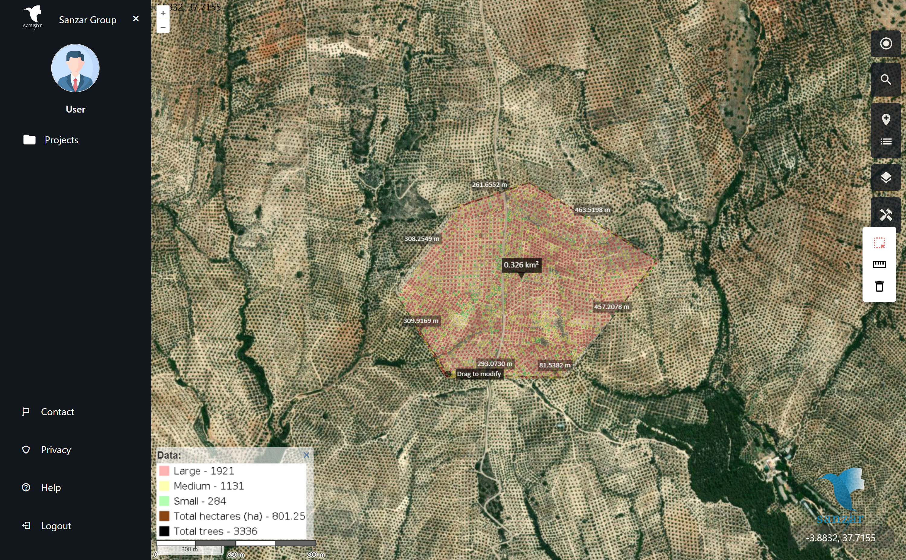
Utilize the power of high-resolution satellite imagery (30 cm/pixel) combined with advanced AI models to achieve on-demand measurements with unparalleled accuracy. This precision is essential for detailed risk and damage evaluations, ensuring you have the most reliable data at your fingertips.
Geolocation & offline
Geolocation & offline
Through our software, you can access your land and view your location in real-time on the map, even offline. This feature ensures you always have the information you need, regardless of your connectivity status.
Use Cases
We help farmers and agribusinesses optimize irrigation and agrochemical use, monitor crop growth, and enhance productivity. Our precise, 30 cm per pixel imagery allows for targeted interventions that not only save costs but also reduce environmental impact, ensuring every square meter of farmland contributes to higher yields and healthier crops.
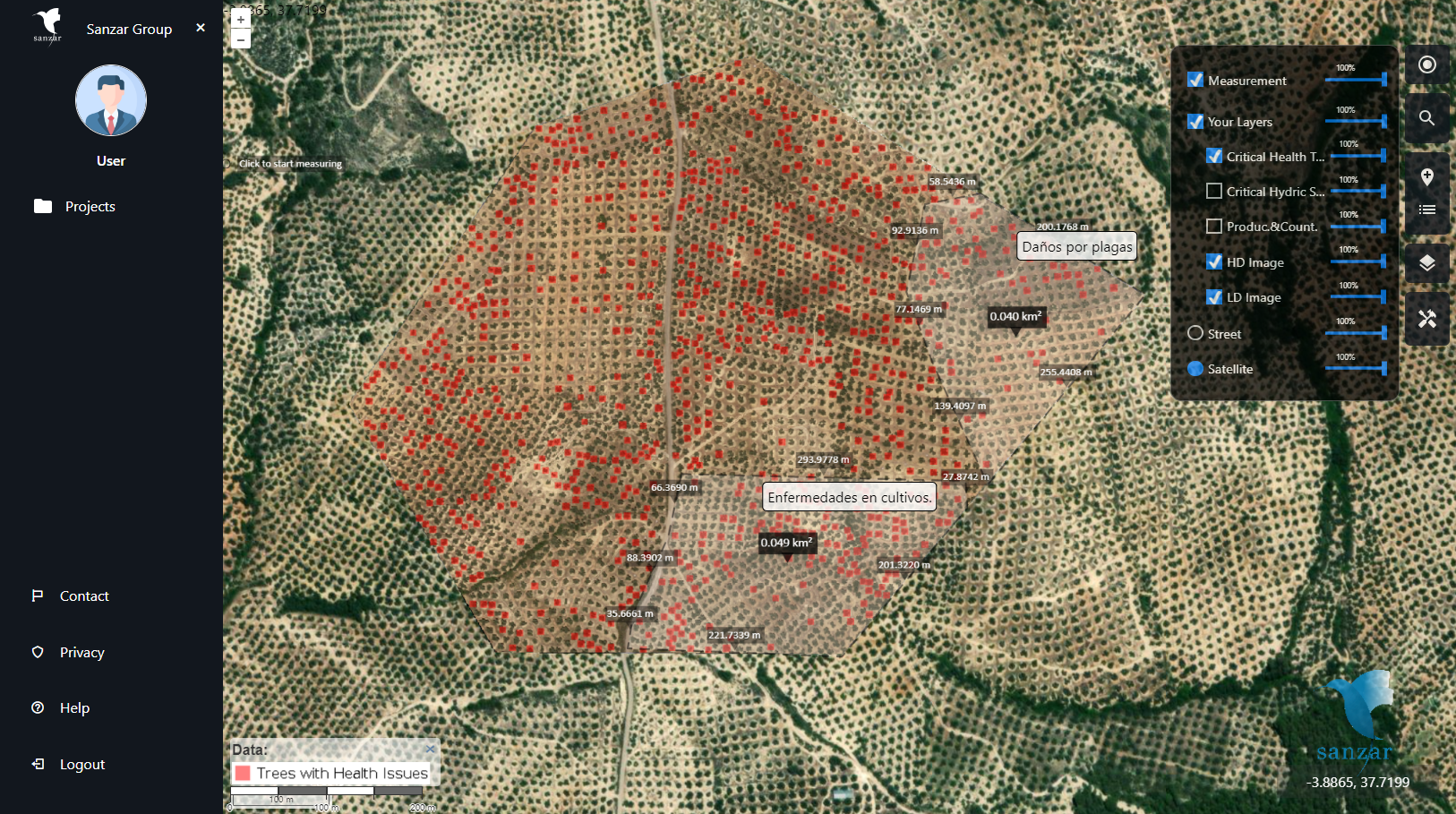
Our high-resolution satellite imagery and AI analysis provide insurers with detailed, accurate data on property conditions before and after claims. This technology helps in assessing risks, managing claims more efficiently, and detecting fraud by providing clear, undeniable evidence of property damage or changes. Insurers can offer more tailored policies and premiums, enhancing customer satisfaction and operational efficiency.
In disaster management, every second counts. Our satellite imagery and AI capabilities allow for rapid assessment of disaster-impacted areas, aiding in efficient allocation of resources and effective planning of recovery efforts. By analyzing changes in land conditions at a high resolution, emergency response teams can prioritize interventions, understand the extent of damage, and monitor recovery progress, helping save lives and rebuild communities.