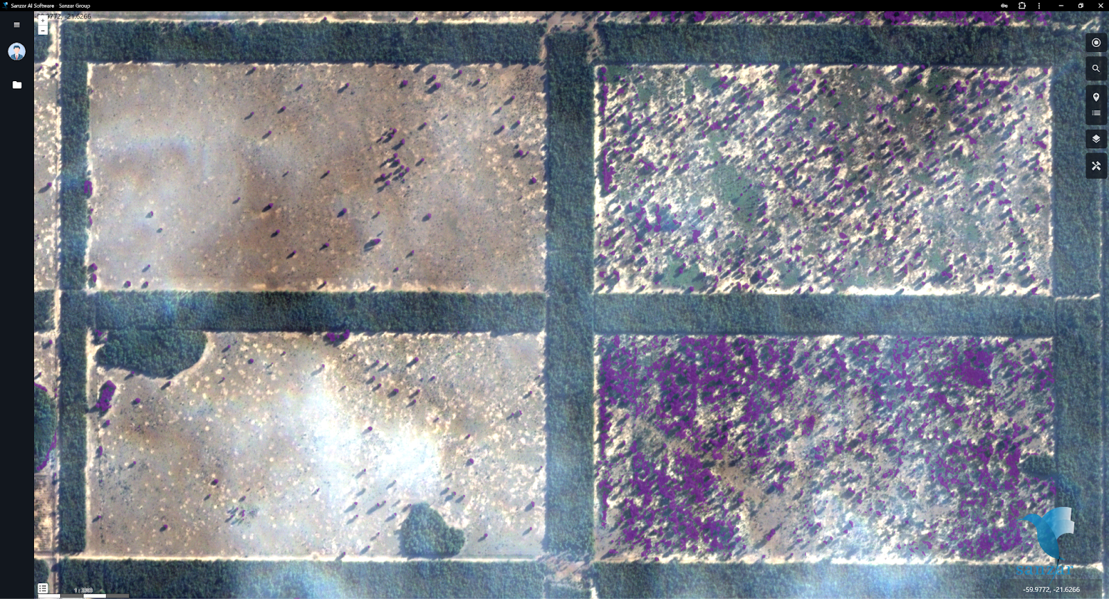
We have developed a customized app for the client with a user-friendly interface, allowing them to interact with the high-resolution orthomosaic map created using our algorithm and captured by our drone equipped with an RGB camera.

For the customized app, we can incorporate different functionalities according to the client’s needs. For this client, on a 7000-hectare plot, we identified non-productive areas within each parcel, enabling us to correct these areas and utilize 100% of the client’s land capacity.

Sanzar Agri-Tech provides a diverse range of personalized services to meet your specific needs. Feel free to get in touch with us and schedule a meeting to enhance innovation and effectiveness in your endeavors!